Published on January 30, 2017
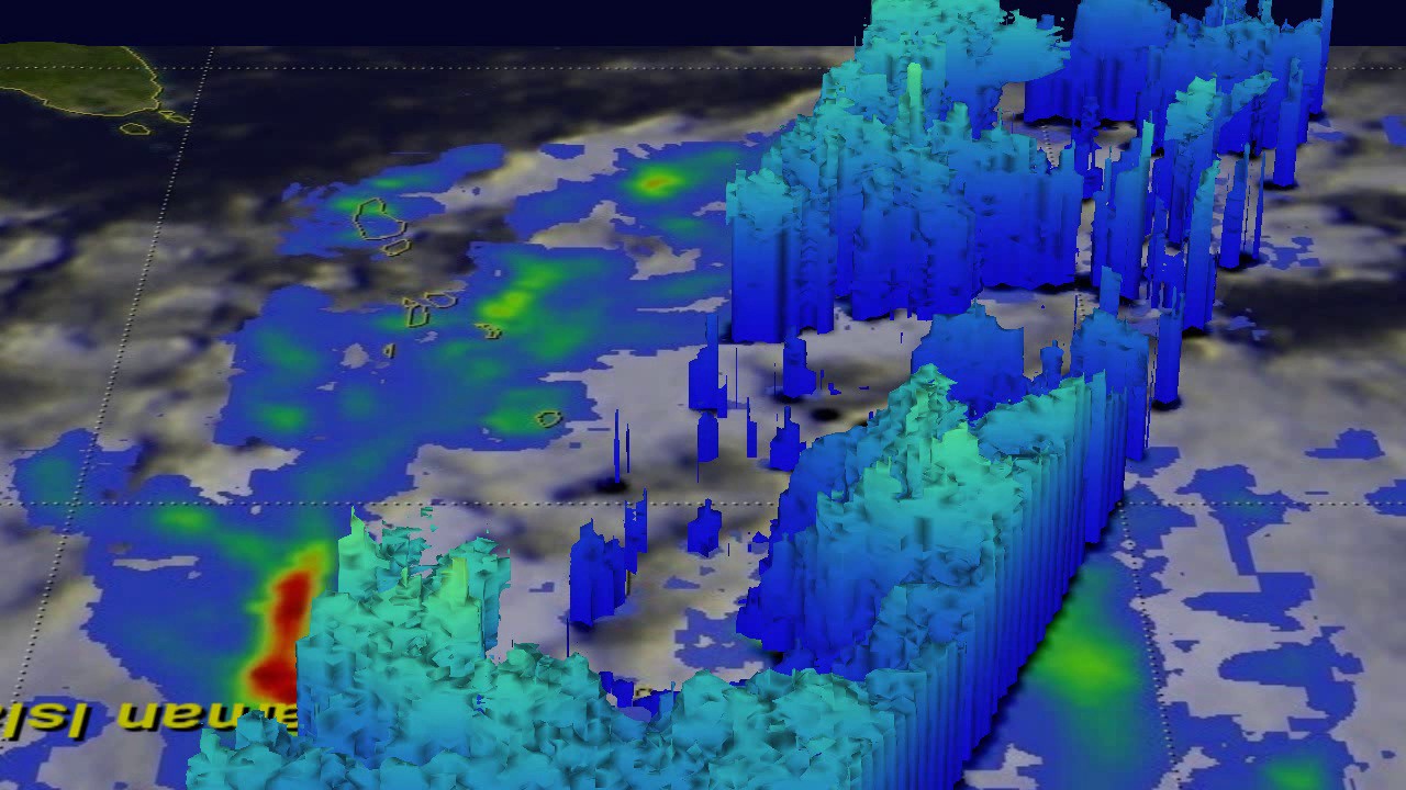
The Global Precipitation Measurement mission or GPM core observatory satellite analyzed Tropical Cyclone Vardah on Dec. 8 at 0301 UTC. GPM’s Microwave Imager (GMI) showed that two intense feeder bands were bringing moisture from the Andaman Sea into the northeastern side of the tropical cyclone. GPM’s Dual-Frequency Precipitation Radar (DPR) coverage is shown in a slightly lighter shade through the center of the tropical cyclone. DPR’s (Ku Band) data revealed that rain was falling at a rate of over 266 mm (10.5 inches) in some of the very strong convective storms moving around the northern side of the tropical cyclone. GPM also showed a slot of dry air moving into Vardah’s southern side. Credit: NASA/JAXA, Hal Pierce
