more at
A basic introduction to lunar and interplanetary navigation for manned spaceflight.
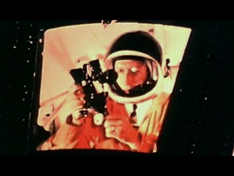
“This film illustrates the methods that were used for determining space trajectories, locating a spacecraft’s position, and navigating both manned and unmanned spacecraft between Earth and other planets. The footage shows, through animation and live photography, the use of computers and other navigational instruments for the lunar mission and future space flights.”
NASA film HQ-116
US Air Force training film TF-6301
Public domain film from the US National Archives, slightly cropped to remove uneven edges, with the aspect ratio corrected, and mild video noise reduction applied.
The soundtrack was also processed with volume normalization, noise reduction, clipping reduction, and/or equalization (the resulting sound, though not perfect, is far less noisy than the original).
Reupload of a previously uploaded film, in one piece instead of multiple parts, and with improved sound.
from JPL Basics of Spaceflight:
“Spacecraft navigation comprises two aspects: (1) knowledge and prediction of spacecraft position and velocity, which is orbit determination, and (2) firing the rocket motor to alter the spacecraft’s velocity, which is flight path control.
Recall from Chapter 4 that a spacecraft on its way to a distant planet is actually in orbit about the sun, and the portion of its solar orbit between launch and destination is called the spacecraft’s trajectory. Orbit determination involves finding the spacecraft’s orbital elements and accounting for perturbations to its natural orbit. Flight path control involves commanding the spacecraft’s propulsion system to alter the vehicle’s velocity. Comparing the accurately determined spacecraft’s trajectory with knowledge of the destination object’s orbit is the basis for determining what velocity changes are needed.
Since the Earth’s own orbital parameters and inherent motions are well known, the measurements we make of the spacecraft’s motion as seen from Earth can be converted into the sun-centered or heliocentric orbital parameters needed to describe the spacecraft’s trajectory. The meaningful measurements we can make from Earth of the spacecraft’s motion are:
Its distance or range from Earth,
The component of its velocity that is directly toward or away from Earth, and
To the extent discussed below, its position in Earth’s sky.
Some spacecraft can generate a fourth type of nav data,
Optical navigation, wherein the spacecraft uses its imaging instrument to view a target planet or body against the background stars.
By repeatedly acquiring these three or four types of data, a mathematical model may be constructed and maintained describing the history of a spacecraft’s location in three-dimensional space over time. The navigation history of a spacecraft is incorporated not only in planning its future maneuvers, but also in reconstructing its observations of a planet or body it encounters. This is essential to constructing SAR (synthetic aperture radar) images, tracking the spacecraft’s passage through planetary magnetospheres or rings, and interpreting imaging results.
Another use of navigation data is the creation of predicts, which are data sets predicting locations in the sky and radio frequencies for the Deep Space Network, DSN to use in acquiring and tracking the spacecraft….
Orbit Determination
The process of spacecraft orbit determination solves for a description of a spacecraft’s orbit in terms of a state vector (position and velocity) at an epoch, based upon the types of observations and measurements described above. If the spacecraft is en route to a planet, the orbit is heliocentric; if it is in orbit about a planet, the orbit determination is made with respect to that planet. Orbit determination is an iterative process, building upon the results of previous solutions. Many different data inputs are selected as appropriate for input to computer software, which uses the laws of Newton. The inputs include the various types of navigation data described above, as well as data such as the mass of the sun and planets, their ephemeris and barycentric movement, the effects of the solar wind and other non-gravitational effects, a detailed planetary gravity field model (for planetary orbits), attitude management thruster firings, atmospheric friction, and other factors.”
