Life in the Central Valley of California 1949 Coronet Instructional Films Sacramento, Fresno…
more at
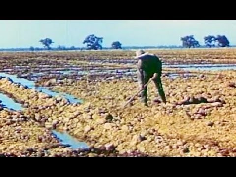
“Shows the agriculture, trade and infrastructure of California’s Central Valley, all made possible by irrigation.”
NEW VERSION with improved video & sound:
Public domain film from the Library of Congress Prelinger Archive, slightly cropped to remove uneven edges, with the aspect ratio corrected, and mild video noise reduction applied.
The soundtrack was also processed with volume normalization, noise reduction, clipping reduction, and/or equalization (the resulting sound, though not perfect, is far less noisy than the original).
California’s Central Valley is a large, flat valley that dominates the central portion of California. It is home to California’s most productive agricultural areas. The valley stretches approximately 450 miles (720 km) from northwest to southeast inland and parallel to the Pacific Ocean coast. Its northern half is referred to as the Sacramento Valley, and its southern half as the San Joaquin Valley. The Sacramento valley receives about 20 inches of rain annually, but the San Joaquin is very dry, often semi-arid desert in many places.
The two halves meet at the huge Sacramento-San Joaquin River Delta of the Sacramento and San Joaquin Rivers, which along with their tributaries drain the majority of the valley. The Delta is a large expanse of interconnected canals, streambeds, sloughs, marshes and peat islands. The Central Valley covers an area of approximately 22,500 square miles (58,000 km2), making it slightly smaller than the state of West Virginia and about 13.7% of California’s total area…
Geology
The flatness of the valley floor contrasts with the rugged hills or gentle mountains that are typical of most of California’s terrain. The valley is thought to have originated below sea level as an offshore area depressed by subduction of the Farallon Plate into a trench further offshore. The San Joaquin Fault is a notable seismic feature of the Central Valley.
The valley was later enclosed by the uplift of the Coast Ranges, with its original outlet into Monterey Bay. Faulting moved the Coast Ranges, and a new outlet developed near what is now San Francisco Bay. Over the millennia, the valley was filled by the sediments of these same ranges, as well as the rising Sierra Nevada to the east; that filling eventually created an extraordinary flatness just barely above sea level; before California’s massive flood control and aqueduct system was built, the annual snow melt turned much of the valley into an inland sea.
The one notable exception to the flat valley floor is Sutter Buttes, the remnants of an extinct volcano just to the northwest of Yuba City which is 44 miles (71 km) north of Sacramento.
Another significant geologic feature of the Central Valley lies hidden beneath the delta. The Stockton Arch is an upwarping of the crust beneath the valley sediments which extends southwest to northeast across the valley…
Environment
The ‘Central Valley Grassland’ is the Nearctic temperate and subtropical grasslands, savannas, and shrublands ecoregion which was once a diverse grassland containing areas of desert grassland (at the southern end), prairie, savanna, riverside woodland, marsh, several types of seasonal vernal pool, large lakes such as now-dry Tulare Lake, the largest lake in the United States west of the Mississippi, Buena Vista Lake and Kern Lake. However much of the Central Valley environment has been removed or altered by human activity including the introduction of exotic plants, especially grasses. The oak woodlands and chapparal that fringe the valley have been categorised as the California interior chaparral and woodlands ecoregion. The wetlands have been the target of rescue operations to restore areas nearly destroyed by agriculture…
Runoff from the Sierra Nevada and the resulting rivers that flow into San Francisco Bay provide some of the largest water resources of California. The Sacramento River is the second largest river to empty into the Pacific from the Continental United States, behind only the Columbia River and greater than the Colorado River…
Agriculture
The Central Valley is one of the world’s most productive agricultural regions and is the largest patch of Class 1 soil in the world. More than 230 crops are grown there. On less than 1 percent of the total farmland in the United States, the Central Valley produces 8 percent of the nation’s agricultural output by value: 17 billion USD in 2002. Its agricultural productivity relies on irrigation from both surface water diversions and groundwater pumping from wells. About one-sixth of the irrigated land in the U.S. is in the Central Valley…
