more at
United States Navy training film MN-9487d
Meteorology: The Cold Front
Low quality print, but good content. There is a broadband hum in the vocal frequencies of the audio which I cannot completely remove.
Public domain film from the US Navy, slightly cropped to remove uneven edges, with the aspect ratio corrected, and mild video noise reduction applied.
The soundtrack was also processed with volume normalization, noise reduction, clipping reduction, and/or equalization (the resulting sound, though not perfect, is less noisy than the original).
Meteorology & Weather playlist:
A cold front is defined as the leading edge of a cooler mass of air, replacing (at ground level) a warmer mass of air, which lies within a fairly sharp surface trough of low pressure. It forms in the wake of an extratropical cyclone, at the leading edge of its cold air advection pattern, which is also known as the cyclone’s dry conveyor belt circulation. Temperature changes across the boundary can be as much as 30 °C (54 °F)[citation needed]. When enough moisture is present, rain can occur along the boundary. If there is significant instability along the boundary, a narrow line of thunderstorms can form along the frontal zone. If instability is less, a broad shield of rain can move in behind the front, which increases the temperature difference across the boundary. They are stronger in the fall and spring transition seasons, and weakest during the summer. When they catch up with the preceding warm front, the portion of the boundary which does so is then known as an occluded front…
Development of cold front
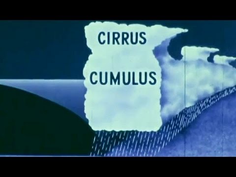
The cooler and denser air wedges under the less-dense warmer air, lifting it. This upward motion causes lowered pressure along the cold front and can cause the formation of a narrow line of showers and thunderstorms when enough moisture is present. On weather maps, the surface position of the cold front is marked with the symbol of a blue line of triangles/spikes (pips) pointing in the direction of travel. A cold front’s location is at the leading edge of the temperature drop off, which in an isotherm analysis would show up as the leading edge of the isotherm gradient, and it normally lies within a sharp surface trough. Cold fronts move faster than warm fronts and can produce sharper changes in weather. Since cold air is denser than warm air, it rapidly replaces the warm air preceding the boundary.
In the northern hemisphere, a cold front usually causes a shift of wind from southwest to northwest clockwise, also known as veering, and in the southern hemisphere a shift from northeast to southwest, in a clockwise manner…
Precipitation
A cold front commonly brings a narrow band of precipitation that follows along the leading edge of the cold front. These bands of precipitation are often very strong in nature, and can bring severe thunderstorms, hailstorms and/or tornadoes. In the spring, these cold fronts can be very strong, and can bring strong winds when the pressure gradient is tighter than normal. During the winter months, cold fronts sometimes come through an area with little or no precipitation. Wider rain bands can occur behind cold fronts which tend to have more stratiform, and less convective, precipitation. These rainstorms sometimes bring flooding, and can move very slowly when the storm steering it is strong and embedded within a meridional flow pattern (with more pole to equator motion rather than west to east motion). In the winter, cold fronts can bring cold spells, and occasionally snow. In the spring or summer in temperate latitudes, hail may occasionally fall along with the rain. If moisture is not sufficient, such as when a system has previously moved across a mountain barrier, cold fronts can pass without cloudiness.
Undercutting
The idea that cold air wedges, or undercuts, the warm air is often used to depict how advancing cold fronts force warm air to rise along the sloping cold air, much like a snow shovel scooping up snow, creating instability. Provided with sufficient moisture, the rising air would thus condense, creating storms, clouds, and/or rain. While this concept is used to generally describe frontal precipitation patterns, it is technically incorrect.
Frontogenetical Circulation
Frontogenesis is the process of creating or steepening the temperature gradient of a front…

