This animation of GOES-East visible and infrared imagery shows the development and track of Tropical Storm Erika from Aug. 25 to Aug. 28, 2015 ending in eastern Caribbean Sea. Credit: …
This animation of images captured August 25 to 27 from NOAA’s GOES-West satellite shows Tropical Storm Erika approaching the Leeward Islands and Puerto Rico. TRT: 00:36 Credit: NASA/NOAA GOES Project
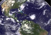
This animation of visible and infrared imagery from NOAA’s GOES-West satellite from Aug. 27 to 29 shows Tropical Storm Erika move through the Eastern Caribbean Sea and dissipate near eastern …